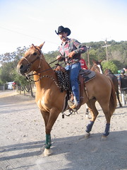
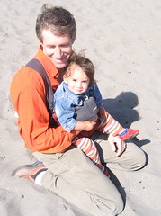
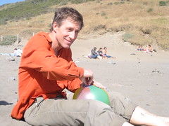
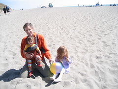
Pre-Teen Boozing at Team Penning
posted by Greg Kidd at
11:05 PM
|
0 Comments
![]()
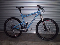
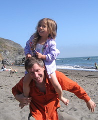
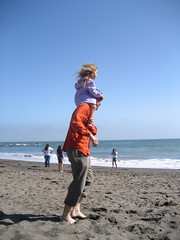
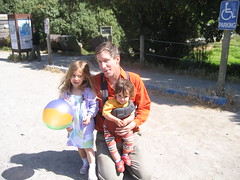
Erik has finally gotten a bike that will fit his 6' 6'' stature -- complete with dual suspension and 29 inch wheels. Not many of these babies in NZ. Watch out for the mountain man on the Rotorua trails.
posted by Greg Kidd at
5:02 PM
|
0 Comments
![]()
Jack Dorsey Presents Twitter from biz stone on Vimeo.
posted by Greg Kidd at
12:50 AM
|
0 Comments
![]()
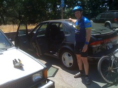
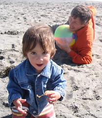
Did I leave the car unlocked, but I left the doors wide open and the keys on the roof....all in the name of getting out on the trail at Skeggs. This was the state of the car upon our return. Nothing touched!
posted by Greg Kidd at
10:53 PM
|
0 Comments
![]()
CANADA TO MEXICO
The Great Divide Route is geographically divided into five different regions. The diverse nature of the regions makes for an incredible visual, sometimes spiritual experience. The route offers something different every day. No day is the same as the day before -- whether it be riding conditions, scenery, points of interest, or folks along the way. It is a route to be enjoyed for what it has to offer rather than rushing through it.
A wide variety of road conditions exists along this route. Surfaces can be pavement, good gravel roads, four-wheel-drive roads, singletrack, or old railroad beds. There is an excellent opportunity to view wildlife such as bears, deer, wild horses, pronghorn antelope, eagles, osprey, sandhill cranes, and other birds and animals. The route is rich in history, with ghost towns, deserted mines, wagon routes, and old Spanish land grants. The route is near or also goes through national parks such as Glacier, Yellowstone, and Grand Teton. Temperatures tend to be chilly at night and cool to warm in the days as you are in mountainous regions most of the way. Wind really isn't a factor along the route because you spend a lot of time in the cover of trees, with the exception of the Great Basin area. Snow, hail, and afternoon thundershowers are a factor. Getting up and riding early to avoid the afternoon thundershowers is advisable. Medical help is often a long way off, so riding within your abilities and being aware of dangers is a must. Mosquitoes are a fact of life -- take repellant.
Beginning at the Canadian border and heading south to Helena, Montana, you are in the deep woods and steep mountains near Glacier National Park and the Bob Marshall Wilderness. This area is native to grizzly bear, elk, moose, mountain lion, thick woods, and has some difficult climbing. Snow can be found on some of the roads until mid-June, and this region can have very cold, harsh weather until July. Montana is characterized by mountainous riding in tall forests with occasional dips into small towns. It is also noted for its friendly people. The capital city in Montana, Helena, has less than 40,000 people and a nice small-town feel to it. The other big town along the route is Butte, which has a definite blue-collar, mining flavor. Montana also has the toughest downhill on the route -- nicknamed "thermarest hill" for all the thermarests it has eaten. Even the hardiest riders have to walk this one.
From Butte to Pinedale, Wyoming, you'll be riding through wide-open mountain valleys. The vegetation thins out into valleys with many different varieties of sage and high-elevation alpine woods. The route crosses the Continental Divide many times, and the climbing is longer with very steep sections on some of the roads. You'll see many, many cows. You leave Montana crossing the divide into Idaho. You are only in Idaho for 72 miles and ride along some blue-ribbon fishing streams and an old railroad bed on the west side of Yellowstone National Park. You'll cross into Wyoming between Yellowstone and Grand Teton National parks on a very scenic road with some great backcountry campsites and a genuine undeveloped hot springs. The route cuts through a corner of the Tetons before heading east up over the divide again and then down the west side of the Wind River Range. The prettiest alpine region on the whole route can be found here. Just south of Pinedale, Wyoming, is a stretch with the worst mosquitos on the entire route but makes for a great character builder. Farther on there's the unforgetable sensation of riding on the crest of the divide for several miles. You then hit an extremely picturesque section of high desert following the Lander cutoff -- part of one of the westward wagon routes. Water is very scarce through here, so carry plenty. After dropping into the twin ghost towns of South Pass and Atlantic City, you will cross the Great Basin -- a place of almost no drinkable water and no trees. Big northwest winds blow across vast open territory marked with wild horses and antelope. Rawlins, Wyoming, marks the end of the desert.
From southern Wyoming to northern New Mexico, you'll be in the Colorado Rockies. The ascents on the route stretch out to long mountainous climbs at elevations starting at 8,000 feet or above. Incredible aspen stands, huge mountains, beautiful alpine meadow flora, historical tourist towns, and a less remote wilderness setting are the characteristics of this state. Expect early evening thunderstorms and cold nighttime temperatures. The highest pass of the route is Indiana Pass, elevation 11,910 feet, in southern Colorado. Soon after crossing it, you get to see firsthand what kind of scars mining can leave on the land as you pass right through a federal Superfund site. Heading into New Mexico, the road surface deteriorates, with much more rocky riding. Here the countryside turns much drier, and water sources can be few and far between. Climbs get shorter and steeper. Geographically this region is as remote as any place in the continental United States. Mesas, cliff lines, volcanic formations, and mountain ranges that seem to pop right out of the desert floor are major visual features of this area. Many different cactus and grass varieties somehow provide habitat for small rodents, snakes, and lizards. Townspeople are right out of Old Mexico, with Spanish spoken more than English. Late-summer monsoon rains turn roads into sloppy, red clay and can fill many of the dry creek beds on the route in seconds. Roads are impassable until they dry out. This area is both historically and anthropologically dominated by the rich Native American and southwestern Spanish culture. Coming down the east side of the Gila Wilderness is a welcome relief, with water once again available as you head into Silver City, New Mexico, a place noted for learning about Anasazi culture with the Gila Cliff Dwellings National Monument north of town and a good museum at the local university. From there it is a sprint south (mostly on pavement) to the border crossing, which consists of one building on the border and nothing else for miles and miles.
Terrain
With the exception of the Great Basin in Wyoming, you will be going either up or down for the entire route. The elevations are lower in Montana -- building up to the highest passes in Colorado and then tapering back off in New Mexico. Some of the toughest climbs are in Montana and New Mexico, though, because of the steepness and the poor road quality. And in New Mexico you'll be carrying extra food and water for the serviceless stretches.
Remoteness Equals Limited Services
The remoteness of this route translates to long stretches of country without basic services, particularly emergency services. All services are minimal at best, except near larger towns, and communication coverage is only about 5 percent of the route. About one third of the overnights are characterized as undeveloped wilderness sites, and most others are Forest Service sites with pit toilets and a water source. Food sources are usually small-town establishments, convenience stores, and campground groceries with limited supplies. Towns are spaced every two to three days along most of the route. They tend to be extremely small and often have limited services. It is necessary to be flexible in what you eat. Showers, flush toilets, drinking water, and laundromats are sometimes widely spaced. It is good to have some back-country camping experience before riding the Great Divide to know how to minimally impact the land. The Great Basin in Wyoming and New Mexico both call for long-mileage days and carrying food and water for several days at a time.
Tough on Equipment
The Great Divide Route is extremely hard on equipment. The weight of your gear exponentially multiplies the stress of riding steep, fast, rough downhills. Wheels, tires, and drivetrains (chains, cassettes, bottom brackets, chainrings) take a lot of abuse and might need replacing along the course of the entire route. Suspension equipment on the bicycle helps to mitigate the abusive nature of the terrain. That said, nylon pivots of some full-suspension bikes wear out extremely fast and are not recommended. Suspension seatposts, good handlebar grips, and front-suspension forks help smooth out the many miles of washboarded and chuckholed roads. Weighting a suspension fork with panniers works well, evens the weighting of the bike, and adds little extra stress to the fork. Trailers also work well and lighten the rear triangle of the bike. Well-made camping gear is essential for the many nights of high-elevation cold, dew, and rain. A well-ventilated, free-standing, three-season tent covered by a rainfly with ample vestibule space and a "footprint" ground tarp is a must. Sleeping bags should be rated to below 20 degrees Fahrenheit, and inflatable mattresses add comfort and warmth. A lot of effort must be taken to keep your possessions dry. Pannier covers, dry bags, and plastic freezer bags all work well to keep the rain and dew off clothing and gear. Good rain gear is also essential.
posted by Greg Kidd at
1:17 AM
|
1 Comments
![]()

Subscribe to
Posts [Atom]